Connect with us

Technology

Network Rail and CATALYST Complete Exploratory Pilot of Satellite-Enabled Risk Insights on the Wessex Route

Published

on

Innovative pilot project combined Earth Observation data, analytics derived from satellite imagery and weather forecasting to explore how flooding and vegetation risks could be identified earlier to improve inspection and decision-support.

LONDON, Aug. 10, 2026 /PRNewswire/ — Network Rail, the owner and operator of Britain’s railway infrastructure, and CATALYST (PCI Geomatics), a specialist in Earth Observation analytics, have completed an exploratory Pilot project that used satellite imagery, InSAR analytics and meteorological forecasting to investigate how weather-driven risks to rail infrastructure across the Wessex Route could be identified prior to an event.

The 12-week Pilot involved collaboration between Network Rail’s Wessex Route Operations and Resilience teams and CATALYST. The exploratory work produced a prototype for an Earth Observation [EO]-enabled decision-support solution that combines satellite-derived risk indicators with short-range weather forecasts. The solution explored how to provide visibility to respond to potential flooding and vegetation risk on a route up to three (3) days in advance of the forecasted weather.

Background

Britain’s rail network is increasingly exposed to climate-driven hazards. Extreme heat, prolonged rainfall and changing vegetation conditions are placing growing pressure on tracks, embankments and cuttings. This is particularly acute in regions where clay-rich geology, dense vegetation corridors and exposure to summer extremes combine to create a uniquely challenging operating environment.

The Project

The Pilot brought together Network Rail’s operational expertise on the Wessex Route, which spans the major commuter area of south-west London, with CATALYST’s advanced Earth Observation capabilities. The result is a prototype that fuses satellite optical and radar imagery and meteorological datasets to generate location-specific risk forecasts for three hazard classes: ground deformation, vegetation fall-in, and flooding.

The solution uses a two-part framework that distinguishes between persistent susceptibility and short-term weather-driven amplification. A baseline analysis quantifies the underlying vulnerability of each rail segment using 3-year archives of satellite imagery, LiDAR-derived vegetation height models and national flood and terrain datasets. A forecast layer then applies up to 3 days of meteorological forecasting (including cumulative rainfall, peak rainfall intensity and wind gusts) to highlight where conditions are likely to elevate risk on a given day.

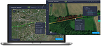
The solution also incorporated an interactive web-based dashboard with intuitive traffic-light classification, to produce results refreshed daily across three rail segments along the Wessex Route.

Benefits

Satellite-derived risk forecasts have the potential to materially improve the way Rail Operators anticipates and respond to weather-driven disruption.  In the Pilot, the prototype highlighted locations where flooding or vegetation risks could be elevated. Subject to further development and validation, these insights could complement existing inspection planning and resource prioritisation. The Pilot also explored when conditions deteriorate, information that could help route teams make more informed operational decisions, for example on routing, speed restrictions and vegetation clearance.

Early feedback from Network Rail operational users on the Wessex Route confirmed that the outputs were broadly consistent with known risk areas, with tree fall risk noted as a potentially valuable insight. Where vegetation assessments currently occur only every three years, a satellite-enabled approach could allow for more frequent, evidence-based monitoring, with the potential to support, supporting earlier identification of high-risk corridors and more efficient deployment of vegetation teams.

By demonstrating the methodology on one of Network Rail’s most climate-sensitive regions, the prototype could be scaled for Rail Operators on a network wide basis, adding additional hazard classes such as wildfire risk and autumn leaf-fall adhesion.

Quotes

“Network Rail supports the continued development of space-enabled technologies as part of a wider, complementary toolset for infrastructure risk management. This pilot has explored how satellite-derived datasets and weather information could give operational teams an earlier view of potential vegetation and flooding risks. We look forward to seeing how this type of capability continues to mature across the Earth Observation industry, with the potential to support more targeted inspections and interventions, reduce avoidable disruption, and continue to build resilience on climate-sensitive routes “
Thomas Desmond, Operations Director, Network Rail

“Rail infrastructure operates at the intersection of geology, vegetation and weather, and that is exactly where Earth Observation excels. By combining InSAR data, vegetation modelling and flood susceptibility data with short-range weather forecasts, we can provide richer, more timely insight: not just where the risk is, but how it is changing day to day. This Pilot is an important step towards demonstrating the potential of satellite analytics to support Rail Operators risk mitigation efforts.
June McAlarey, President & CEO, CATALYST (a PCI Geomatics brand)

Notes to Editors

About Network Rail
Network Rail owns, operates, maintains and develops the railway infrastructure in England, Scotland and Wales, including 20,000 miles of track, 30,000 bridges, tunnels and viaducts, and thousands of signals, level crossings and stations. Network Rail’s purpose is to connect people and goods with where they need to be, supporting the UK’s economic prosperity and contributing to the objectives of the UK and Scottish Governments. Its role is to run a safe, reliable and efficient rail network and to deliver a simpler, better, greener railway for customers and communities.

About CATALYST
CATALYST, a PCI Geomatics enterprise, delivers scalable business solutions using the power of Earth Observation data and AI-enabled analytics. With over 40 years of experience in image processing and data integration, CATALYST works with space agencies, satellite providers and commercial clients worldwide. CATALYST is the first commercial entity to offer CEOS-compliant analysis-ready data for both SAR and optical satellite imagery.

Media Contacts

CATALYST / PCI Geomatics: June McAlarey, mcalarey@catalyst.earth

View original content to download multimedia:https://www.prnewswire.com/news-releases/network-rail-and-catalyst-complete-exploratory-pilot-of-satellite-enabled-risk-insights-on-the-wessex-route-302846335.html

SOURCE CATALYST (PCI Geomatics)

Continue Reading

Technology

DocLinq launched to Tackle Fragmented U.S. Healthcare System by simultaneously empowering Patients & Healthcare Providers

Published

on

By

Built by Healthcare Entrepreneurs, Physicians, and Software Innovators, DocLinq Combines AI with Personalized, Physician-Directed Care

COLUMBIA, Md., Nov. 18, 2026 /PRNewswire/ — After years of navigating disconnected medical records, administrative inefficiencies, and challenges keeping patients engaged between visits, three healthcare and technology entrepreneurs set out to develop a better approach.

The result is DocLinq, an AI-powered Care Management Operating System founded by healthcare executive Connor Ferguson, physician Dr. Rajiv Dua, and software architect Syed Gilani. Now available in the athenahealth Marketplace, DocLinq combines clinical intelligence, physician-directed care management, and personalized patient engagement.

“We built DocLinq because we experienced healthcare’s challenges firsthand,” said Ferguson, DocLinq’s CEO. “Our mission is to combine intelligent technology with physician-directed care, helping healthcare organizations operate more efficiently while strengthening the personal connections patients value.”

DocLinq uses AI-powered insights to help care teams identify potential gaps in care and indicators that may warrant clinical review. Physicians establish individualized care plans, while nursing professionals coordinate patient engagement and follow-up. Organizations can use their existing nursing teams, DocLinq’s nursing professionals, or both.

“Effective chronic disease management depends on what happens between office visits,” said Dr. Dua, DocLinq’s Chief Medical Officer. “DocLinq connects physician-directed care plans with consistent nursing follow-up, supporting proactive, personalized care while keeping physicians at the center of clinical decisions.”

Gilani, DocLinq’s Chief Technology Officer, brings expertise in software architecture, healthcare interoperability, and artificial intelligence. His leadership helped incorporate security considerations from the platform’s earliest development stages, contributing to DocLinq’s receipt of an independent SOC 2 Type II report in November 2026.

Central to DocLinq’s patient experience is Chloe, an AI-powered personal care assistant, which facilitates patient conversations, gathers patient-reported information, and supports care team communication. Combined with electronic health records (EHRs), Health Information Exchanges (HIEs), compatible wearable devices, and digital screeners, Chloe advances DocLinq’s vision of empowering patients to become the “Source of Truth” for their healthcare journey, complementing verified clinical records with patient-generated insights.

DocLinq’s development builds on experience supporting Centennial Medical Group, a Maryland healthcare organization with consistent year-over-year shared-savings performance and a commitment to delivering high-quality chronic disease care.

“Artificial intelligence should never replace the personal connection in healthcare. It should make that connection stronger,” Ferguson concluded.

About DocLinq

DocLinq is an AI-powered Care Management Operating System supporting physician-directed care, population health management, and personalized patient engagement. Designed for EHR and HIE interoperability, subject to technical compatibility, the platform supports APCM, CCM, PCM, and other coordinated care programs.

DocLinq | Smarter Technology. Stronger Connections. Better Care.

Learn More: www.thedoclinq.com

Media Contact
DocLinq
Columbia, Maryland
Email: Connor@thedoclinq.com
Phone: 844-DOCLINQ
Website: www.thedoclinq.com

View original content to download multimedia:https://www.prnewswire.com/news-releases/doclinq-launched-to-tackle-fragmented-us-healthcare-system-by-simultaneously-empowering-patients–healthcare-providers-302944234.html

SOURCE DOCLINQ Inc

Continue Reading

Technology

Therap Services Expands Mobile Capabilities with Document Storage Module for iOS and Android

Published

on

By

TORRINGTON, Conn., Nov. 18, 2026 /PRNewswire/ — Therap Services, the national leader in HIPAA-compliant electronic documentation solutions for Intellectual and Developmental Disabilities (IDD), Home and Community-Based Services (HCBS), and Long-Term Services and Supports (LTSS) industries, has introduced its Document Storage module to the Therap Mobile Applications for Apple and Android devices. This update allows human services providers to securely upload, manage, and access critical documentation directly from their handheld devices at the point of care.

Streamlined Mobile File Management at the Point of Care

Direct support professionals and administrators often need immediate access to essential records while in the field. The new mobile Document Storage module allows authorized users to upload, search, update, and manage files on the go. Staff can store documents for specific individuals on their caseloads or maintain agency-wide administrative files directly through the app.

Secure, Role-Based Access and In-App Controls

Built-in validation rules help maintain data integrity by checking file parameters—such as required document types, received dates, and file size thresholds—before submission. Robust role-based security settings help agencies restrict file access to assigned caseloads or administrative roles. Super Admins can easily request activation for their organization through the system’s issue tracking setup, preserving administrative oversight and protecting sensitive health information.

Frequently Asked Questions (FAQs)

What is the new Document Storage feature in the Therap Mobile App?
The feature allows authorized staff to securely upload, view, search, and manage individual caseload records and agency-wide files directly from Apple and Android devices.How does Therap’s mobile Document Storage help human services providers?
It provides immediate, on-the-go access to vital records, reducing administrative delays and supporting timely care decisions in field and community settings.How is data security maintained within Therap’s mobile Document Storage?
Access is protected by role-based permissions, limiting document viewing to assigned caseloads while supporting HIPAA compliance natively on secure mobile devices.What other modules are available on the Therap Mobile App?
In addition to Document Storage, the app supports point-of-care tools including T-Logs, ISP Data, Electronic Medication Administration Records (eMAR), Scheduling/EVV, Attendance, Video Library and more.

About Therap Services

Therap Services provides HIPAA-compliant software for documentation, communication, reporting, EVV, and billing.

Learn more: https://www.therapservices.net/


View original content:https://www.prnewswire.com/news-releases/therap-services-expands-mobile-capabilities-with-document-storage-module-for-ios-and-android-302943967.html

SOURCE Therap Services

Continue Reading

Technology

GeoLinks Expands Intracom Telecom Partnership to Scale Licensed mmWave FWA Across the U.S.

Published

on

By

Spectrum as a Service meets fiber-class FWA, creating new opportunities for U.S. service providers

ATLANTA, Nov. 18, 2026 /PRNewswire/ — Intracom Telecom, a global telecommunication systems and solutions vendor, today announced the expansion of its collaboration with GeoLinks, a U.S. provider of next-generation fixed wireless access (FWA) broadband, to support the commercial deployment of licensed 29/31 GHz connectivity. The expanded collaboration combines Intracom Telecom’s WiBAS™ G5 mmWave technology with its uni|MS™ Network Lifecycle Management and Automation platform, enabling centralized network planning, resource allocation, service provisioning, monitoring and optimization.

By combining proven multi-gigabit FWA performance with advanced network automation, Intracom Telecom supports GeoLinks’ ambition to make licensed-spectrum broadband accessible to a wider ecosystem of service providers in the U.S. Through the uni|MS™ Release 13 suite, GeoLinks can centrally plan and manage network resources while maintaining separate network domains for individual service providers. Unified monitoring and automated fault management help streamline operations, reduce the workload of network operations teams and support consistent service quality across GeoLinks’ Spectrum as a Service offering.

Building on a successful live trial in 2025 that achieved 1.6 Gbps of aggregate throughput over five miles in the licensed 31 GHz band, GeoLinks is now rolling out its network across Las Vegas amongst other markets, targeting residential and business subscribers.

GeoLinks holds 208 Local Multipoint Distribution Service (LMDS) licenses in the 29/31 GHz band, and is making this spectrum available to service providers in more than 1,300 counties across the U.S., allowing them to pair it with commercially available radio equipment instead of building or acquiring their own spectrum portfolios. 

“While the industry is making headlines about the potential of gigabit fixed wireless, we’re focused on demonstrating what it can actually deliver,” said Kevin Hetrick, CEO of GeoLinks. “Our work with Intracom Telecom has already achieved 1.6 Gbps of aggregate throughput over five miles, proving that licensed spectrum can be a powerful alternative to traditional fiber deployments. We’re not waiting for the future of broadband. We’re helping build it.”

“Intracom Telecom continues to push the boundaries of licensed mmWave FWA, delivering multi-gigabit performance that sets new standards for the industry,” said Kyriakos Vergos, Chief Wireless Officer, Intracom Telecom. “Our expanded collaboration with GeoLinks demonstrates how advanced wireless technology and network automation can unlock new opportunities for broadband providers across the U.S.”

The solution combines Intracom Telecom’s WiBAS™ G5 point-to-multipoint FWA platform, featuring MU-MIMO, beamforming and beam steering, with its uni|MS™ platform for integrated radio planning, automated service qualification, zero-touch provisioning and network optimization, enabling faster, more efficient and scalable licensed mmWave FWA deployment.

Intracom Telecom is showcasing its WiBAS™ G5 mmWave FWA platform and uni|MS™ Network Lifecycle Management and Automation platform at Broadband Nation Expo, November 18–20, in New Orleans.

About GeoLinks
GeoLinks is a leading telecommunications company delivering innovative connectivity solutions to businesses, communities, and institutions. Founded with a mission to connect underserved communities, GeoLinks has grown into a recognized industry innovator, combining next-generation technology with a commitment to closing the Digital Divide. From high-performance fixed wireless broadband to advanced networking solutions, GeoLinks is helping people and businesses thrive through connectivity they can count on. For more information, visit www.geolinks.com.

About Intracom Telecom 
Intracom Telecom is a global technology systems and solutions provider operating for 50 years in the market. The company is the benchmark in mmWave fixed wireless access, and it successfully innovates in the wireless access & transmission field. Furthermore, the company offers a comprehensive software solutions portfolio and a complete range of ICT services. Intracom Telecom serves telecom operators, public authorities and large public and private enterprises. The Group maintains its own R&D and production facilities, operates subsidiaries worldwide and has been active in the North American market since 2002, through its subsidiary, Intracom Telecom USA, based in Atlanta, Georgia. For more information, visit www.intracom-telecom.com

View original content:https://www.prnewswire.com/news-releases/geolinks-expands-intracom-telecom-partnership-to-scale-licensed-mmwave-fwa-across-the-us-302944066.html

SOURCE Intracom Telecom

Continue Reading

Trending